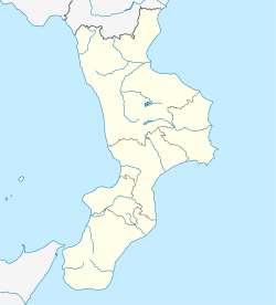
Francavilla Angitola
Appearance
Francavilla Angitola | |
|---|---|
 | |
| Coordinates: 38°47′N 16°16′E / 38.783°N 16.267°E | |
| Country | Italy |
| Region | Calabria |
| Province | Province of Vibo Valentia (VV) |
| Area | |
| • Total | 28.3 km2 (10.9 sq mi) |
| Population (2018-01-01)[2] | |
| • Total | 1,906 |
| • Density | 67/km2 (170/sq mi) |
| Time zone | UTC+1 (CET) |
| • Summer (DST) | UTC+2 (CEST) |
Francavilla Angitola is a comune (municipality) in the Province of Vibo Valentia in the Italian region Calabria, located about 30 kilometres (19 mi) southwest of Catanzaro and about 20 kilometres (12 mi) northeast of Vibo Valentia.
Francavilla Angitola borders the following municipalities: Curinga, Filadelfia, Maierato, Pizzo, Polia.
In the località of Ponte Angitola, in the comune, was the Roman settlement and river crossing named Ad Fluvium Angitulam or Annicia.[3]
Demographic evolution
[edit]
References
[edit]- ^ "Superficie di Comuni Province e Regioni italiane al 9 ottobre 2011". Italian National Institute of Statistics. Retrieved 16 March 2019.
- ^ "Popolazione Residente al 1° Gennaio 2018". Italian National Institute of Statistics. Retrieved 16 March 2019.
- ^ Richard Talbert, Barrington Atlas of the Greek and Roman World, (ISBN 0-691-03169-X), Map 46.


